Geographic Information Systems
Geographic Information Systems
A Gateway to Exciting Career Opportunities with Hands-On GIS Training
A Gateway to Exciting Career Opportunities with Hands-On GIS Training
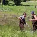
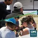
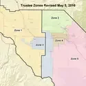
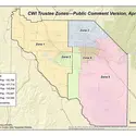
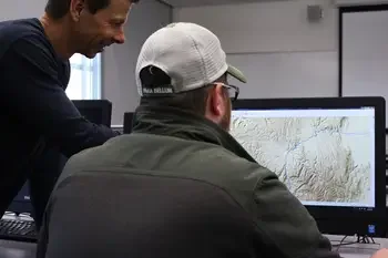
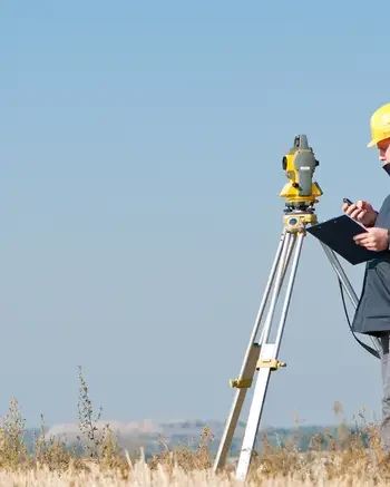
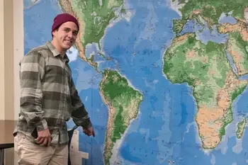
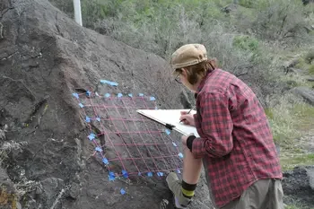
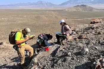
Interested in the innovative field of Geographic Information Systems (GIS)? College of Western Idaho’s (CWI) GIS Academic Certificate program is dynamic and interactive with classes designed to provide you with fundamental skills, knowledge, and experience necessary for entry into the GIS field. GIS, a rapidly growing industry, uses computer software to manage, manipulate, analyze, and display geospatial data, revealing geographic patterns and trends not apparent with traditional maps or databases.
This GIS program is ideal for both students and working professionals, emphasizing critical thinking, data analysis, and problem-solving. You will engage in both independent and collaborative projects, gaining hands-on experience with industry-standard GIS software. Whether you are complementing your existing major or expanding your career opportunities, this certificate prepares you for diverse roles in business, healthcare, public health, natural resources, emergency management, logistics, and more.
Annual Openings*
Hourly Median Wage*
Annual Median Salary
Growth (2025 – 2035)*
Annual Openings*
Hourly Median Wage*
Annual Median Salary
Growth (2025 – 2035)*
Annual Openings*
Hourly Median Wage*
Annual Median Salary
Growth (2025 – 2035)*
Hourly Median Wage*
Annual Median Salary
Growth (2025 – 2035)*
*Data sourced from Lightcast™ (2026), a global leader in labor market analytics, and limited to the state of Idaho. Contact CWI Institutional Research for questions regarding this data. Career pathways may require further education beyond CWI.

Cost & Aid
As a student in this program, you may be eligible for financial aid and scholarships.

Enrichment Opportunities
Enhance your academic experience, expand your knowledge, reach your goals, and celebrate your achievements.
Advising
Already a student? We are here to help you navigate your educational journey, connect you to academic and support resources, and achieve your academic or career goals.
Transfer Information
Plan ahead for a smooth transition to a four-year college or university.
Explore Cultural and Physical Landscapes Through Interdisciplinary Studies
Explore Human Cultures and Histories Through a Holistic Approach
Integrated, Hands-On Studies Preparing You for a Career or to Transfer On
Start Your Mining Career with Practical Skills and Industry-Ready Training
Interested in learning more about this program or getting started? Fill out the information below to be contacted by a member of our team.
Ready to get started? Our team looks forward to assisting you!
One Stop Student Services
Locations